


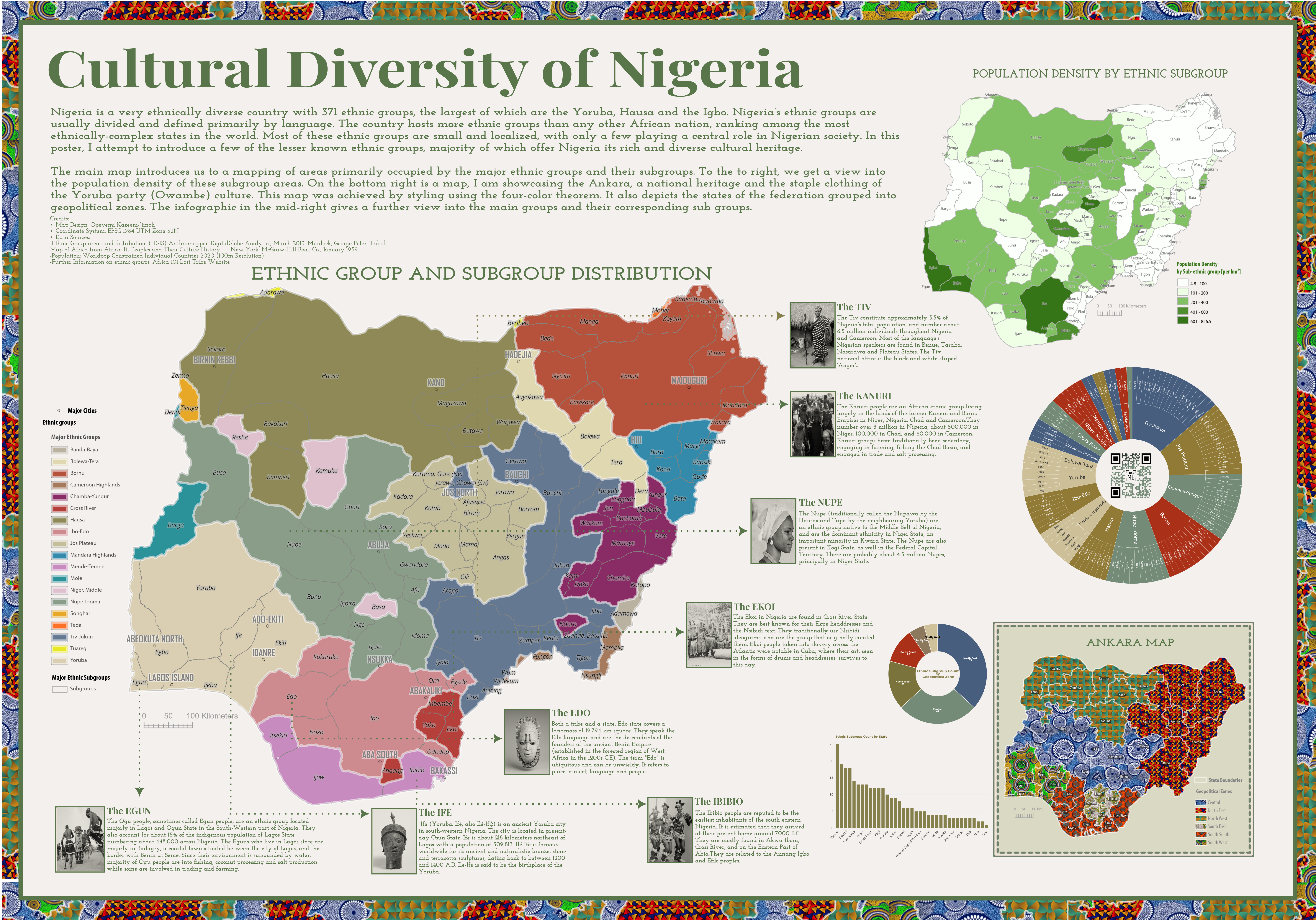
Nigeria's Ethnicity
The standard output of a cartographic work is usually in the form of a poster. This goes beyond just the map that is being showcased but extends to other accompanying elements that are crucial to fully pass the intended message across. This includes appropriate headings and subheadings, description of the content, data visualization, images e.t.c. Beyond this, the principles of design must be upheld. Significant attention must be paid to achieving balance and structure in map and poster layout to aid usability.
This poster showcases the cultural diversity of my home country Nigeria. It contains the important elements discussed above including also an interactive element in form of the QR Code in the center right data visualization.
Due to the external source of the QR code, it may not always be available.
- Maps created in: ArcGIS Pro
- Design Software: InkScape
- Data Visualization: Flourish Studio